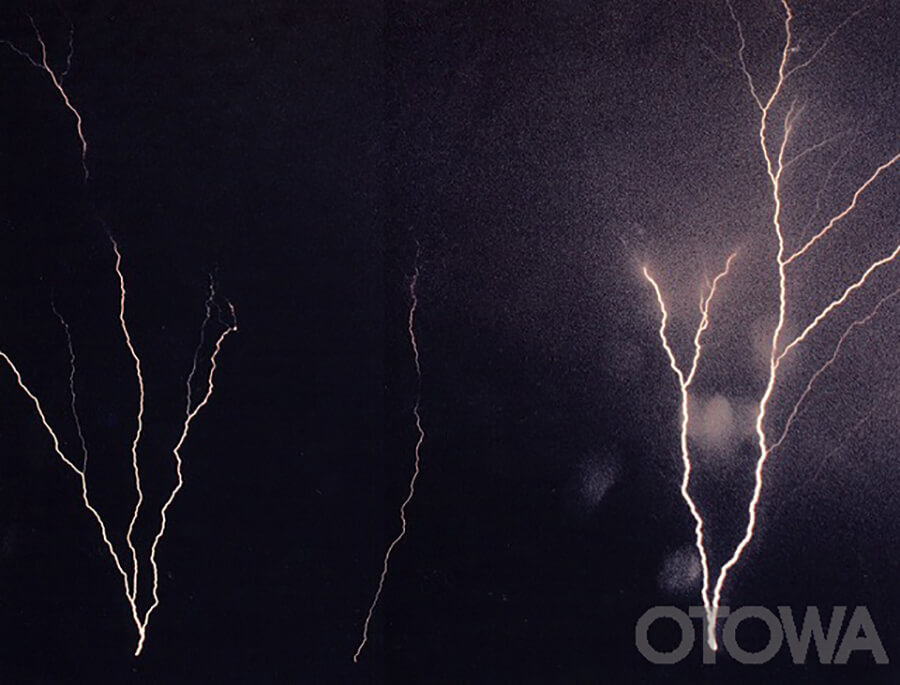
The 6th Lightning Photo Contest, cademic Work Prize, THUNDER IN OPPOSITE BANK (ECHIZEN COAST)
People tend to think that lightning is a meteorological phenomenon that occurs mostly in summer, but in fact lightning occurs in winter as well. Outside of Japan's Sea of Japan coast, lightning is limited to the Atlantic coast of Norway, making it a very rare meteorological phenomenon even from a global perspective.
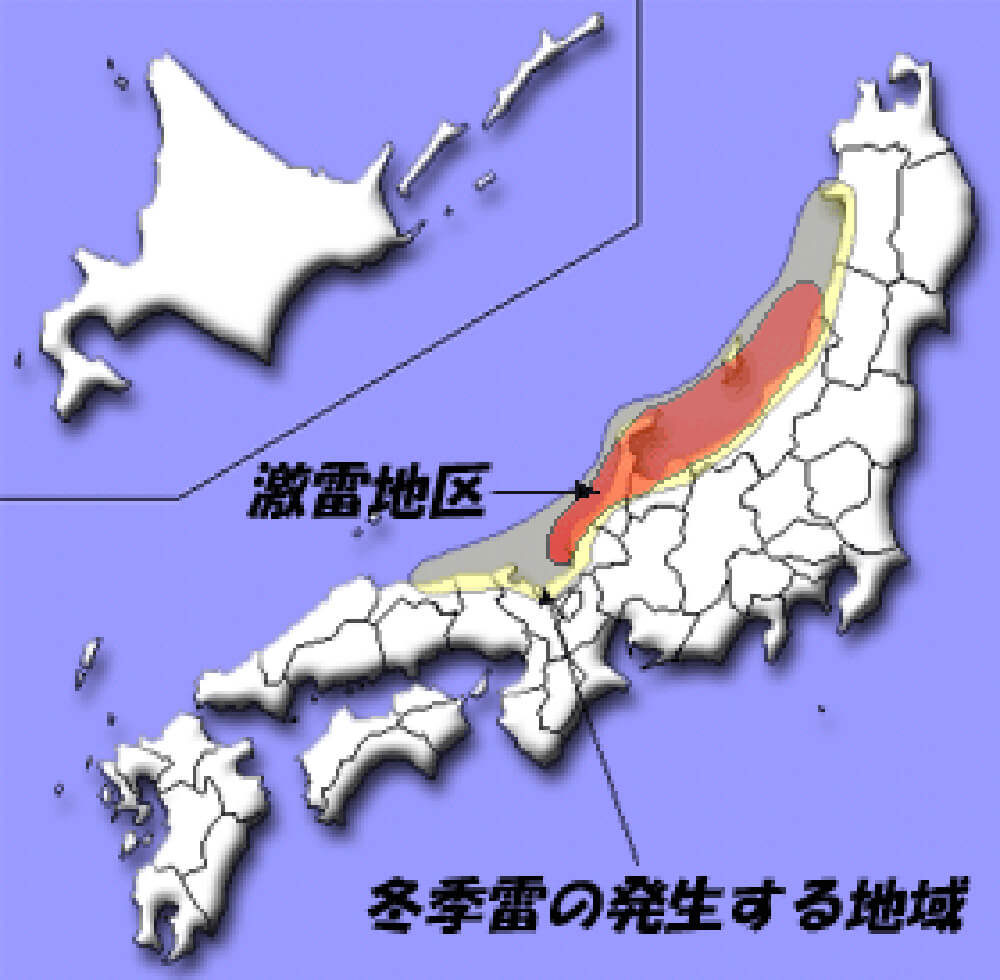
The majority of thunderstorms occur along the coast of the Sea of Japan from Akita Prefecture to Tottori Prefecture, and inland from the coastline to about 35 km. The area along the Sea of Japan coast from Niigata to Fukui prefectures is a severe thunderstorm area.

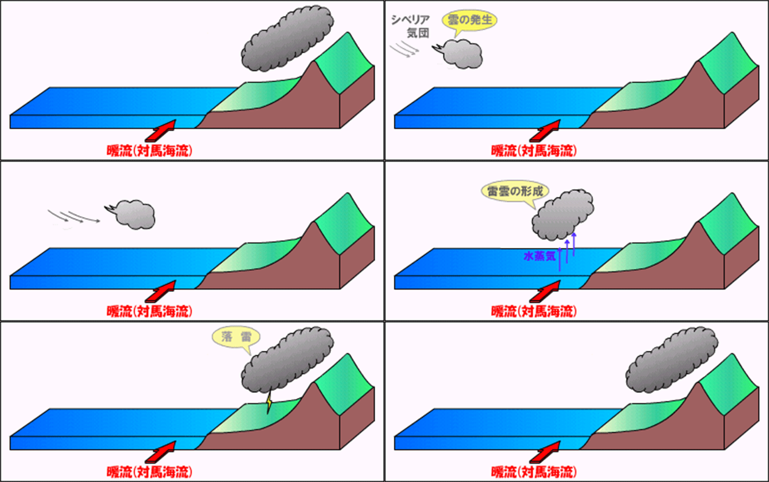
In winter, the cold monsoon from the continent (Siberian air mass) causes clouds to form over the sea. When the clouds cross the Sea of Japan on the air currents, they contain abundant water vapor generated by the temperature difference between the cold monsoon and the warm current (Tsushima Current) that flows along the coast of Honshu, and form thunderclouds at low altitudes of a hundred to several hundred meters.
The thunderclouds then spread over a wide area from the coast of the Sea of Japan to mountainous areas due to fronts and updrafts, causing snowfall and lightning strikes. In particular, since thunderclouds are formed at low altitudes, lightning strikes are concentrated in mountainous areas and plains where there are high structures.

In summer lightning, most lightning discharges start downward, but in winter lightning, in many cases, the discharges start upward. The discharge starts from a high structure, such as the tip of a building, towards the sky.
The energy of winter lightning is very high, and can be more than 100 times higher than that of summer lightning.
The interaction between the cold air from Siberia and the warm current (Tsushima Current) moving northward over the Sea of Japan creates an updraft, which can cause lightning to occur around the clock.
Summer lightning discharges repeatedly, but winter lightning is called "one-shot" lightning, and in most cases, once it discharges, it does not discharge for a while.

The 2nd Lightning Photo Contest, Academic Work PrizeCompetition of winter lightnings